The Last Glacial Period
How Ice Accumulates
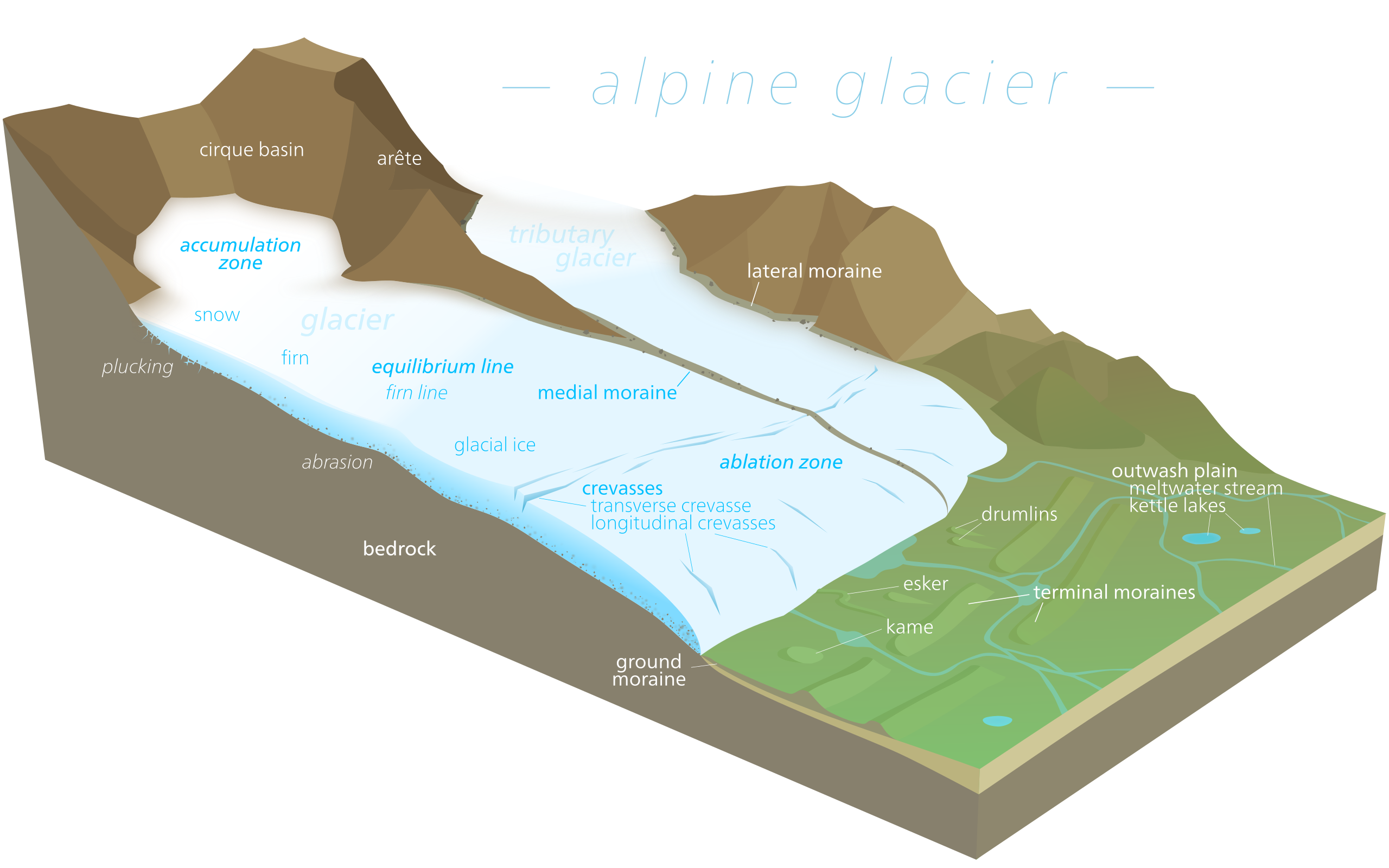
Every glacial period is unique in its consequences. The contients on Earth are continuously drifting. The tectonic plates deep beneath the surface often collide with one another, causing an increase in volcanic activity. Once cooled, the magma and lava ejected during volcanic activity forms the foundation of new land mass. The position and motion of the tectonic plates is a key aspect of ice formation. Fault lines are not only the focal point for volcanic and seismic activity, but often produce terrain high above sea level as plates collide. In the initial stages of a stadial period, mountaintop glaciers begin at the point of highest elevation called an "accumulation zone". As the cold period progresses, ice spreads to other parts of the range. Each major mountain range on Earth produces an ice cap corresponding glacier during stadial periods. What distinguishes one stadial from another are the mountain ranges actively producing the global cooling effect throughout its duration, and to what extent.
Our most current ice age marks the end of the Pleistocene, and ends around 12k years before present. Most glaciation effecting the continents and life habitats occurred in the northern hemisphere. The Greenland ice sheet and the Arctic sea are the most direct factor in producing lasting ice deposits in the north, acting as a sort of reservoir for other ice formations. However, major glacial deposits accumulated around all the major mountain ranges in the northern hemisphere.
The Eastern Hemisphere
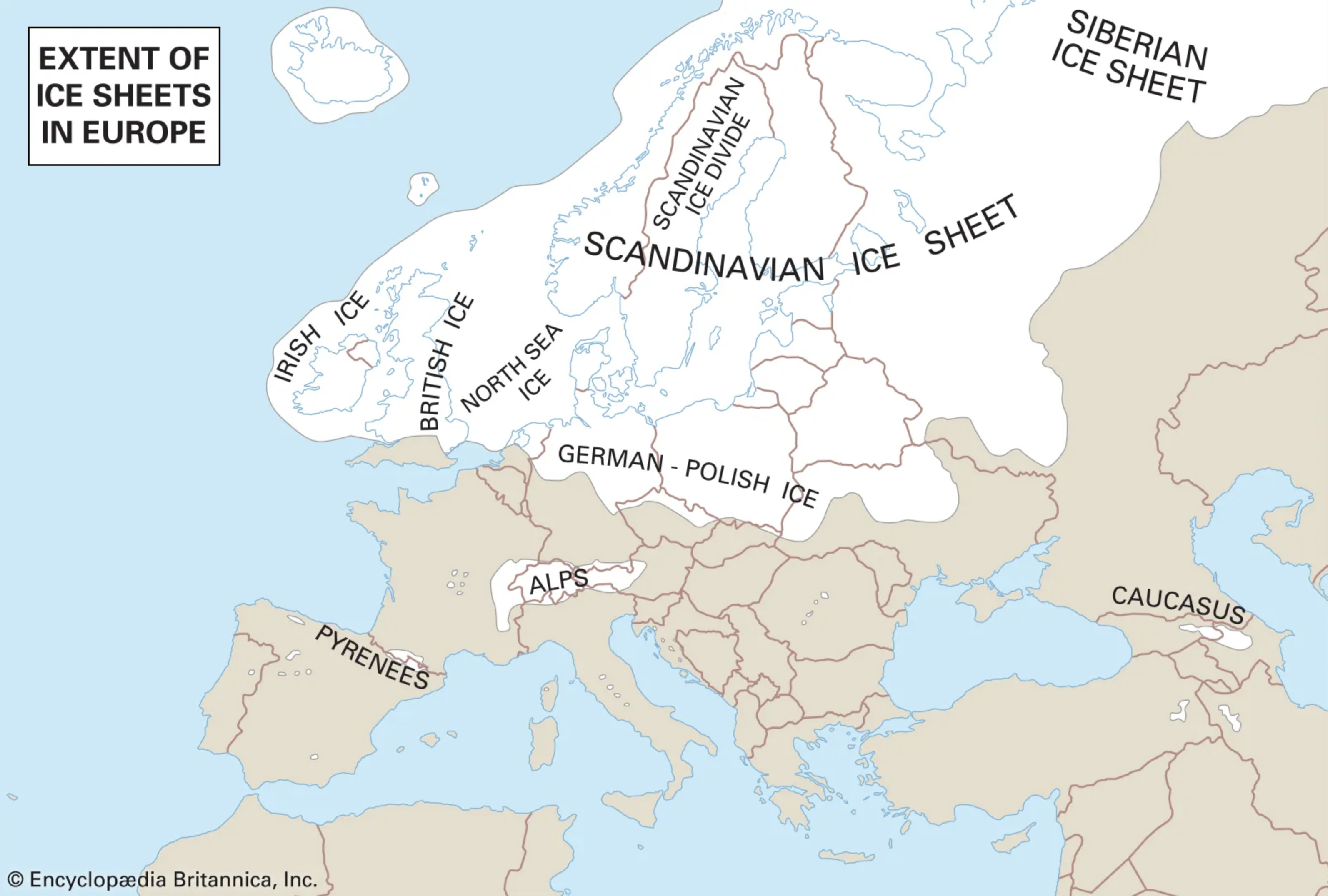
Glaciation throughout the Eurasian continent was dramatic. The Finnoscandian ice-sheet extended from the Scandinavian Mountains as far east as Moscow. Southward, it extended to the 48th degree latitude. The major cause of glaciation can be directly linked to the eastward progression of the Greenland ice-shelf. Decreasing temperatures and excess moisture caused the ice caps on the Scandinavian Mountains to accumulate and initiate a positive feedback loop in the region. Mountainous ice caps caused moderate glaciation in the Himalaya Mountains to a lesser extent. The Swiss Alps were home to a large glacial formation separate from the much larger Scandinavian shelf. Siberia and Asia were too dry to support glaciation to the same extent, although mountaintop glaciation did occur.
The Western Hemisphere
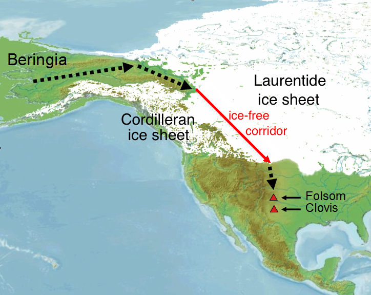
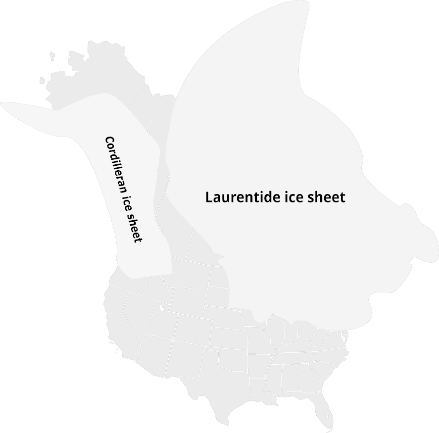
North America was a nexus of glacial activity during the last glacial maximum in the western hemisphere. Ice from Greenland and the Arctic region fragmented into glaciers which drifted southwest to the Americas. The Laurentide Ice-Sheet was a monumental glacier roughly 2 miles thick. It covered all of present-day Canada and the United States as far south as the Ohio River (38 degrees latitude). The Great Lakes in the US are the drain water from the Laurentide as it receded at the end of the Pleistocene. In the west, the Cordilleran ice sheet stretched from just south of Alaska into the north-western US. South America experienced glaciation around the Venezuelan Andes mountain range, but its effects were much less pronounced than in the north.
The Bering Strait
Across the planet, sea levels were much lower. Many continents have considerably large continental "shelves" which are regions that have been submerged in shallow ocean water. During stadial periods, these shelves may be exposed due to changes in sea level. The exposed shelves may create a "corridor" that allows passage by land between two previously isolated continents. Land bridges can be found all over the planet when sea levels lower; in Europe, Great Britain is joined with the European continent, Australia is connected with Papua New Guinea during periods of low sea level. Perhaps the most prominent instance is in a region geologists refer to as "Beringia" located in the far northeast of Asia. The Bering Strait links Siberia with Alaska during stadial periods. Although much debate surrounds the topic, many archaeologists agree that this was the means by which early human populations entered the Americas around 15,000 years ago.